
MÉRTOLA
37° 38′ 25″ N; 7° 39′ 40″ W
The municipality is limited to the north by the municipalities of Beja and Serpa, to the east by Spain, to the south by Alcoutim, and to the west by Almodôvar and Castro Verde.
The Municipality of Mértola is based in the homonymous village of Mértola, a village with more than 2 000 inhabitants. The village is located on an elevation on the right bank of the Guadiana River, immediately upstream of the confluence of the Oeiras stream.
Climate
Mértola has a warm and temperate climate, predominantly Mediterranean, with hot and dry summers, a consequence of the interior. Winters are mild and not rainy.
According to the Köppen-Geiger climate classification, the climate classification is Csa. The average annual temperature is 17.1 ° C. The average annual rainfall is 505 mm. The driest month is July and has an average of 2 mm of precipitation. With an average of 76 mm, the rainiest month is December.
History
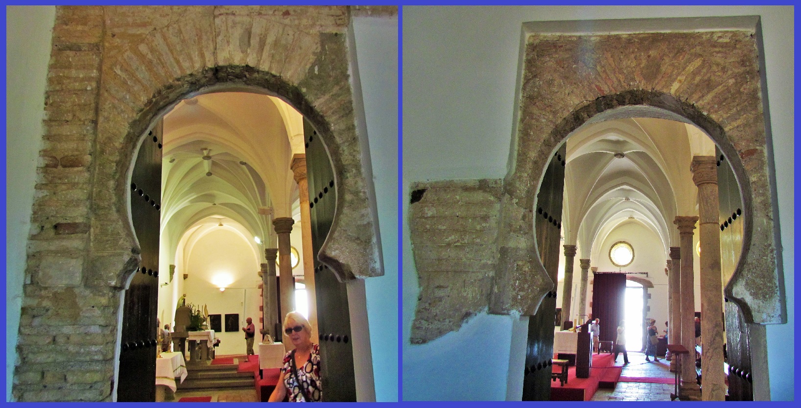
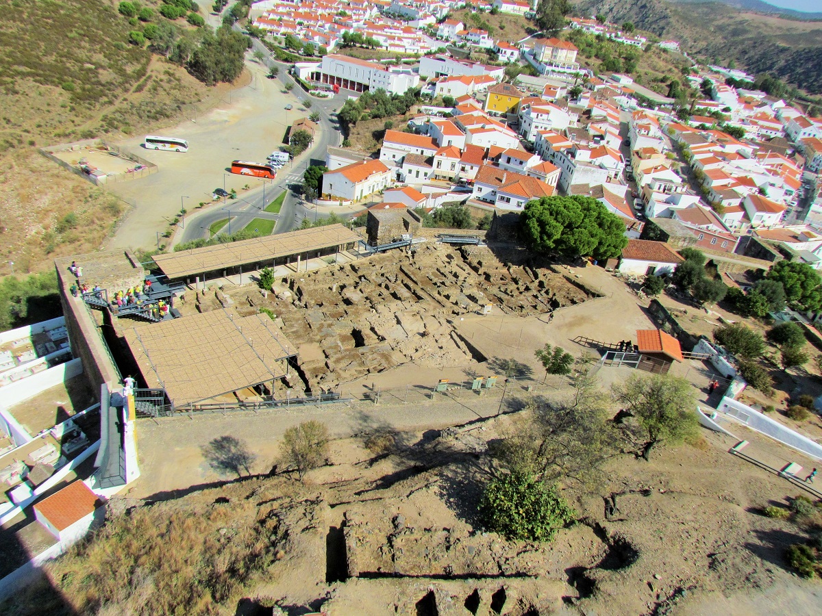
Archaeological excavations have resulted in the discovery of traces that date back to the Neolithic period. After the Roman invasion of the Iberian Peninsula, the occupation by the Visigoths and the Muslim invasion followed. With the invasion of the peoples of North Africa, led by General Tárique in 711, Mértola gains a new dynamic, becoming the westernmost port in the Mediterranean. The exceptional geographical position on the last navigable section of the Guadiana will be decisive for its growth and heyday.
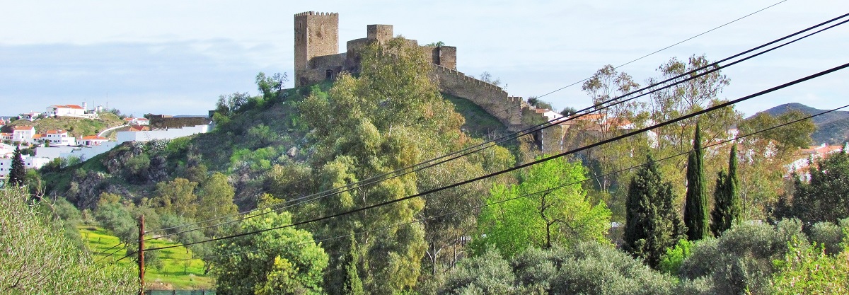
Mértola was constituted as an important river port, with its castle rising in a dominant position over that stretch of the Guadiana River. Its importance was such that, for a short period of the 11th century, it was the capital of a small independent Islamic emirate, Taifa de Mértola.
At the time of the Christian Reconquest, Mértola was not regained from the Moors until 1238.


To the north of Mértola, through the new bridge and the road to Serpa, 17 km away, you discover the São Domingos Mine - the mines were the main source of employment for the village. (37.672912º N, 7.496646º W)
There is a hotel and an attractive river beach in the small reservoir, very popular on summer weekends.
The pier on the São Domingo Mine line, which filled the boats with the extracted ore, is a 20-minute drive south, along the N265 national road to Pomarão, next to the Spanish border.

