
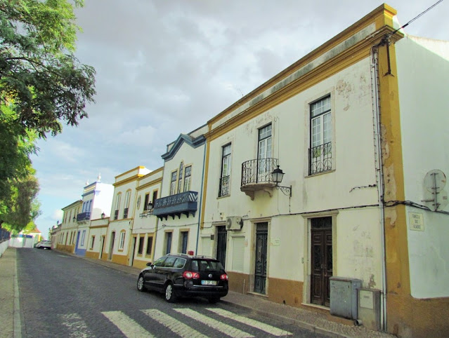
CASTRO VERDE
37° 41′ 51.45″ N, 8° 04′ 54.7″ W
It is the seat of the homonymous municipality of Castro Verde, which has an area of 569.44 km² and 7 276 inhabitants (2011), subdivided into 4 parishes (Castro Verde e Casével; Entradas; Santa Bárbara de Padrões; São Marcos da Ataboeira).
The municipality is limited to the north by the municipalities of Aljustrel and Beja, to the east by Mértola, to the south by Almodôvar, and to the west by Ourique.
Castro Verde is located in Baixo Alentejo, in the Alentejo region, in a territory known as Campo Branco. A large part of the municipality's territory is within an area of the European Union's Natura 2000 Network, represented by a Special Protection Zone for endangered steppe bird species such as the bustard and the kestrel.
Mining activity in this region dates back thousands of years, with remnants of mining structures dating back to Roman times when the region played a significant role in the expansion of Roman metallurgy. This southern part of Lusitania was a Roman province and, for several centuries, it was an abundant source of ore minerals including gold, silver, copper, tin, lead, and iron.
Castro Verde is a UNESCO Biosphere Reserve.
Climate
The Atlantic Ocean has little influence in this region, where rain falls mainly in autumn and winter, characteristic of a Mediterranean climate Csa, according to the Köppen-Geiger climate classification system, sub-humid, with hot and dry summers and humid winters and smooth. The average annual total rainfall is 589 mm.
Economy
The municipality of Castro Verde has an economy very focused on the secondary sector that represents 32.7% of employment, mainly after the opening of the Neves-Corvo Mine, which guarantees the extractive industry 80% of jobs and 98% of the turnover secondary sector.
The service sector, or tertiary sector, represents, after the mining sector, the predominant activity in the region, where it houses 56.2% of the employed population, being the sector that represented the biggest growth in the last decade, both in job generation and in volume. of business.
Geographic location.
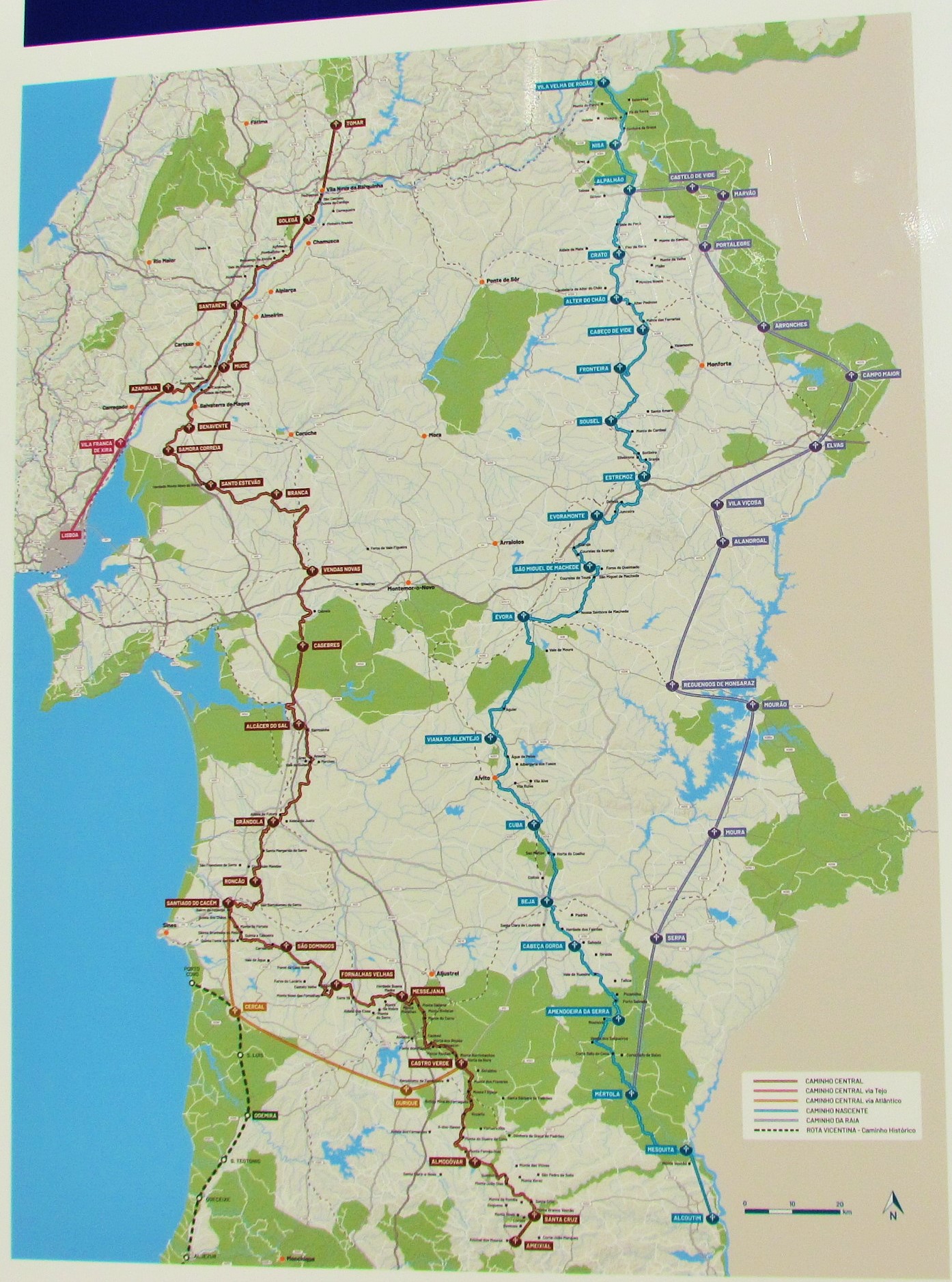
The village of Castro Verde is located in Baixo Alentejo, in Portugal, 180 km southeast of Lisbon, and 80 km north of the Algarve coast. It is served by the A2 motorway, the exit node being about 8 km west of Castro Verde. The distances to the airports are Lisbon - 190 km, Beja Airport - 53 km, Faro - 10 km, and Seville - 27 km.


Climate
The Atlantic Ocean has little influence in this region, where rain falls mainly in autumn and winter, characteristic of a Mediterranean climate Csa, according to the Köppen-Geiger climate classification system, sub-humid, with hot and dry summers and humid winters and smooth. The average annual total rainfall is 589 mm.
Economy
The municipality of Castro Verde has an economy very focused on the secondary sector that represents 32.7% of employment, mainly after the opening of the Neves-Corvo Mine, which guarantees the extractive industry 80% of jobs and 98% of the turnover secondary sector.
The service sector, or tertiary sector, represents, after the mining sector, the predominant activity in the region, where it houses 56.2% of the employed population, being the sector that represented the biggest growth in the last decade, both in job generation and in volume. of business.
Geographic location.
The village of Castro Verde is located in Baixo Alentejo, in Portugal, 180 km southeast of Lisbon, and 80 km north of the Algarve coast. It is served by the A2 motorway, the exit node being about 8 km west of Castro Verde. The distances to the airports are Lisbon - 190 km, Beja Airport - 53 km, Faro - 10 km, and Seville - 27 km.


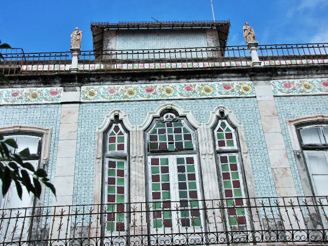
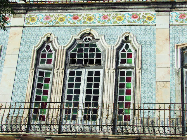
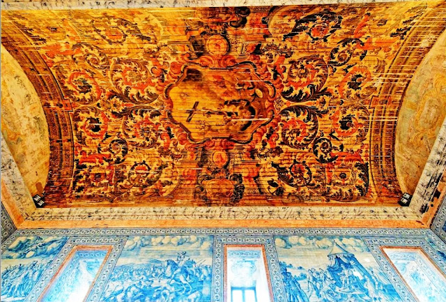
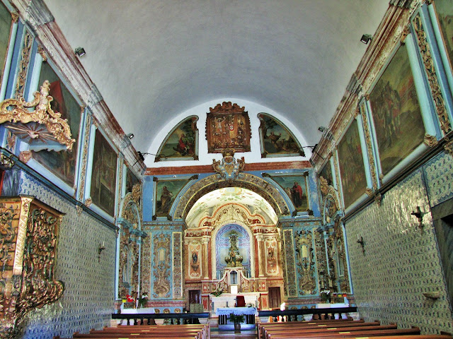
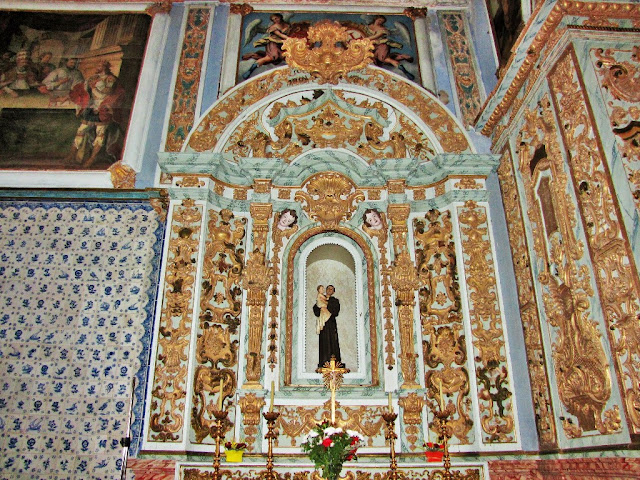
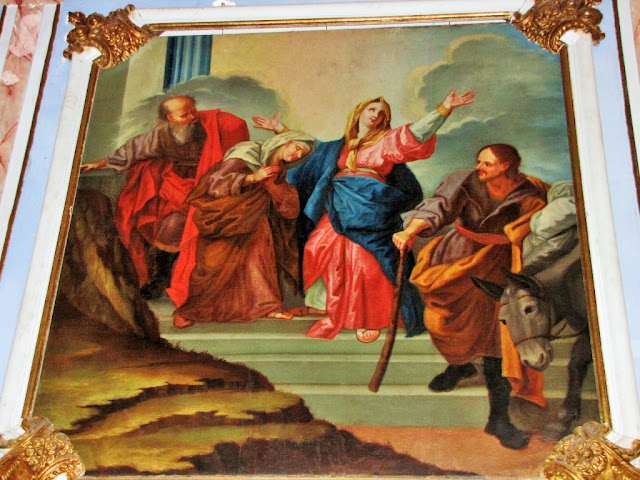
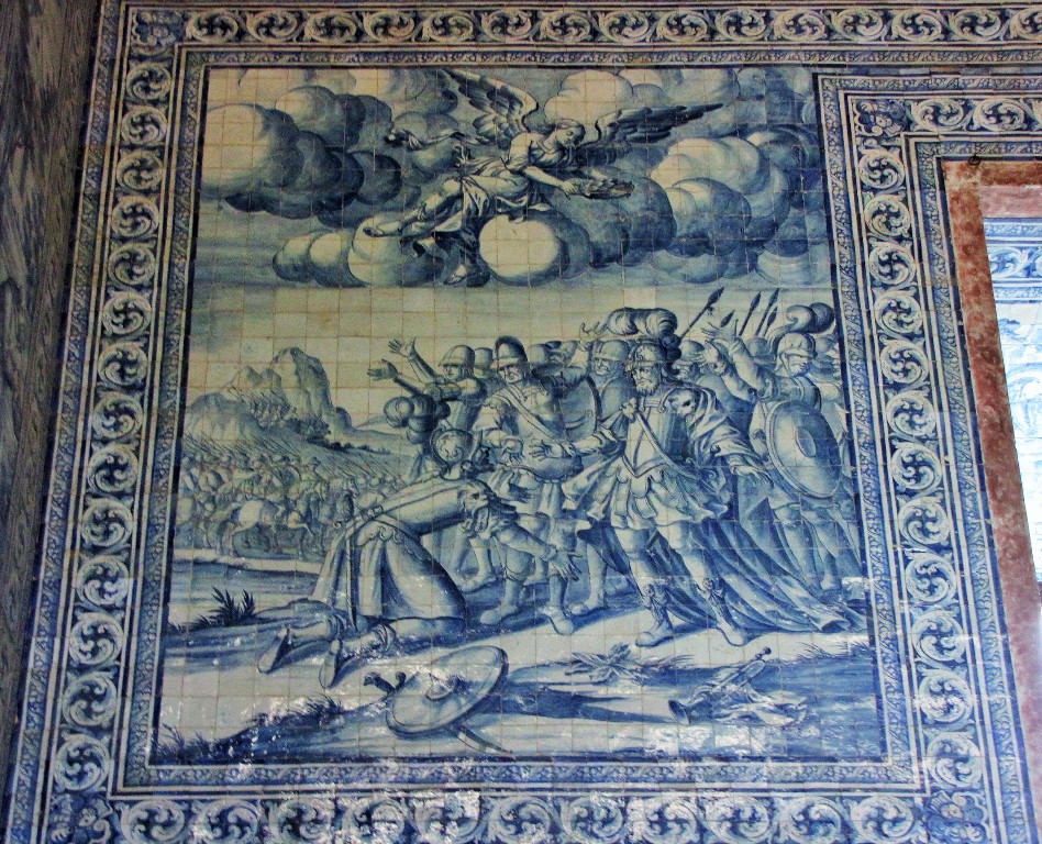
Royal Basilica of Castro Verde.
(Igreja Matrizde Castro Verde)
The Church of Nossa Senhora da Conceição, also referred to as the Castro Verde Mother Church and the Royal Basilica of Castro Verde was built in the 16th century, in honor of the Battle of Ourique, having replaced an earlier church, probably built during the 15th century. It was rebuilt in the 18th century. The building includes a museological nucleus, the Treasury of the Royal Basilica, where several sacred pieces of the municipality are exhibited.


Chagas do Salvador Church
(Igreja das Chagas do Salvador)


